Sience Field
Governmental Institutions => Geographical Survey Institute(GSI)
Project => Governmental Institutions
| Overview | |
|---|---|
| Title | Leveling |
| Sub-Title | Altitude |
| Data Summary | Leveling was conducted on East Ongul Island in order to detect the uplift rate of post-glacial rebound confirmed by the crustal activity of the Antarctic area and the coastal area of Antarctica. Leveling was planned because raised water's edge was observed in the exposed rock area and it was assumed that slopes would be observed both on the west and east sides of Ongul Island due to the difference in uplift rate. All leveling was conducted in conformity with first-order leveling. |
| About Observation | |
| Spatial Coverage | |
| Data Location | Benchmark |
| Observaion Period / Temporal Coverage |
1979 - present |
| Data Period | 1979 1982 1983 1992 1996 1997 - |
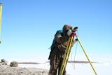
| Observation Photo |

|
| Data Details | |
| Data Name | Leveling |
| Data Format | Analogue |
| Data Recording / Acquisition Sampling |
Irregularity |
| Observation Instruments | Level Wild N-3 Wild NA-3003 |
| Sample Data |
leveling routes on East and West Ongul Islands |
| Publication | |
| Publication method | Report Metadata/AMD: Leveling |
| Data Policy | |
| Data Center (Contact Person) |
Deputy Director of Physical Geodesy Div., Geodetic Dept., Geospatial Information Authority of Japan |
| gsi-antarctic-seika (at) ml.mlit.go.jp | |
| Related Organization | National Institute Polar Research |
| Scientific Results / Publication |
|
| Digital Object Identifier(DOI) | |
| Creator | |
| Publisher | National Institute of Polar Research |


