Sience Field
Governmental Institutions => Geographical Survey Institute(GSI)
Project => Governmental Institutions
| Overview | |
|---|---|
| Title | Antarctic region color photo |
| Sub-Title | |
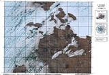
| Data Summary | Photographic image maps were drawn in conformity with the international standard mapping rules for Antarctica and the standard rules for basic map in Japan. GSI drew 67images at a scale of 1:2500 and 129images at scale of 1:10000 from 1993 to 2004. Photographic maps were drawn by 2001 based on Geodetic Reference System 1967, Bessel's ellipsoide and universal transeverse Mercator's Projection. after 2002, Photogaraphic map were drawn that based on Geodetic Reference System ITRF2000, Geodetic Reference System 1980 ellipsoid universal transeverse Mercator's Projection |
| About Observation | |
| Spatial Coverage | |
| Data Location | |
| Observaion Period / Temporal Coverage |
1993 - 2005 |
| Data Period | 1993 - 2005 |
| Observation Photo |
Photograph of Antarctica region color picture
|
| Data Details | |
| Data Name | 67images at a scale of 1:2500 and 29images at scale of 1:10000 |
| Data Format | Printed map and image ( AI format) |
| Data Recording / Acquisition Sampling |
|
| Observation Instruments | |
| Sample Data |
A figure of 1/10,000 color photos |
| Publication | |
| Publication method | These achievements such as topographical maps can be inspected in the Library of the National Institute of Polar Research, and it is kept at Syowa Station, Antarctica. Metadata/AMD: Geographic Survey Institute (GSI) Aerial Photographs for Japan Antarctic Research Expedition (JARE) Metadata/AMD: Geographical Survey Institute (GSI) Color ortho photo map for the Japan Antarctic Research Expedition (JARE) |
| Data Policy | |
| Data Center (Contact Person) |
Imagery Survey Div., National Mapping Dep., Geospatial Information Authority of Japan |
| gsi-antarctic-seika (at) ml.mlit.go.jp | |
| Related Organization | |
| Scientific Results / Publication |
|
| Digital Object Identifier(DOI) | |
| Creator | |
| Publisher | National Institute of Polar Research |


