Sience Field
Governmental Institutions => Geographical Survey Institute(GSI)
Monitoring => Governmental Institutions
IPY => Governmental Institutions
| Overview | |
|---|---|
| Title | Control point survey |
| Sub-Title | Geography latitude and longitude |
| Data Summary | The reference points to make the topographical map in the Antaratic region are set up. An IGS point (SYOG) was set at Syowa Station on the 36th JARE (1994), it was designated as the substantial point of origin on and after the 37th JARE (1994). As for the control point survey of each exposed rock area, we set or modified the control point using differential positioning by GNSS based on this point of origin. |
| About Observation | |
| Spatial Coverage | |
| Data Location | Control point |
| Observaion Period / Temporal Coverage |
1956 - present |
| Data Period | 1956 - present |
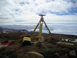
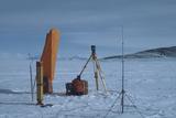
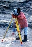
| Observation Photo |


|
| Data Details | |
| Data Name | Control point survey |
| Data Format | Analogue |
| Data Recording / Acquisition Sampling |
Geodetic survey |
| Observation Instruments | theodolite, electronic distance measuring instrument, NNSS, GPS,GNSS |
| Sample Data |
Reference point measurement result table |
| Publication | |
| Publication method | Report Metadata/AMD: Geographical Survey Institute (GSI) Control Point Data for the Japan Antarctic Research Expedition (JARE) |
| Data Policy | |
| Data Center (Contact Person) |
Deputy Director of Physical Geodesy Div., Geodetic Dept., Geospatial Information Authority of Japan |
| gsi-antarctic-seika (at) ml.mlit.go.jp | |
| Related Organization | National Institute Polar Research |
| Scientific Results / Publication |
Reference point measurement result table |
| Digital Object Identifier(DOI) | |
| Creator | |
| Publisher | National Institute of Polar Research |


