


Sience Field
Governmental Institutions => Geographical Survey Institute(GSI)
Monitoring => Governmental Institutions
IPY => Governmental Institutions
| Overview | |
|---|---|
| Title | Antarctic region topographical map |
| Sub-Title | |
| Data Summary | Topography at a scale of 1:5,000 covering Ongul Islands including Showa base was made four sheets for the base construction and management and observation between 1965 and 1987. Topography at a scale of 1:25,000 covering Lutzow-Holm Bay, the exposed rock area facing the Prince Olav Coast, and the Yamato Mountains was prepared between 1965 and 1987. A topographic map at a scale of 1:50,000 covering most of the Sor Rondane Mountains was prepared in 1992. A small-scale 1:250,000 map was published in 1963 and it was revised in 1990. The topographic map prepared in 1970 at a scale of 1:1,000,000 was the only map that covered the fan-like area located between 30E and 45E East longitude. In 1997, a map covering Eastern Queen Maud Land was prepared in accordance with the international standard mapping rules for Antarctica and rules for mapping at a scale of 1:1,000,000. It was published in 1998 with the name changed to Eastern Dronning Maud Land in addition to partially revised contents. |
| About Observation | |
| Spatial Coverage | |
| Data Location | |
| Observaion Period / Temporal Coverage |
1965-01-01 - present |
| Data Period | 1965-01-01 - present |
| Observation Photo |
Antarctic topography map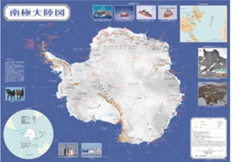
|
| Data Details | |
| Data Name | 5 topographical maps of 1:5,000 and 72 topographical maps of 1:25,000 and 21 topographical maps of 1:250,000 and 4 topographical maps 1:250,000 and 2 topographical maps of 1:1,000,000 |
| Data Format | Printed map |
| Data Recording / Acquisition Sampling |
|
| Observation Instruments | |
| Sample Data |
(left) 1/5,000 topographical maps, (middle) 1/50,000 topographical maps, (right) 1/250,000 topographical maps |
| Publication | |
| Publication method | These achievements such as topographical maps can be inspected in the Library of the National Institute of Polar Research, and it is kept at Syowa Station, Antarctica. Metadata/AMD: 1:50,000 Topographic maps from Japan Antarctic Research Expedition (JARE) Metadata/AMD: Geographical Survey Institute (GSI) 1:25,000 Topographic Maps for the Japan Antarctic Research Expedition (JARE) |
| Data Policy | |
| Data Center (Contact Person) |
Imagery Survey Div., National Mapping Dep., Geospatial Information Authority of Japan |
| gsi-antarctic-seika (at) ml.mlit.go.jp | |
| Related Organization | |
| Scientific Results / Publication |
|
| Digital Object Identifier(DOI) | |
| Creator | |
| Publisher | National Institute of Polar Research |